Pisgah Topographic Landing
A client familiar with our work and a fan of our cut flagstone mosaic patios and paths, engaged us for this project on Beaucatcher Mountain in Asheville, NC. Essentially, he wanted steps and a pathway at his residence and asked us to incorporate a design into the first project, the set of six steps that led from his driveway into a grassy yard. His design mandate was very generous: “Make me something cool.” My response: “We can do that!”
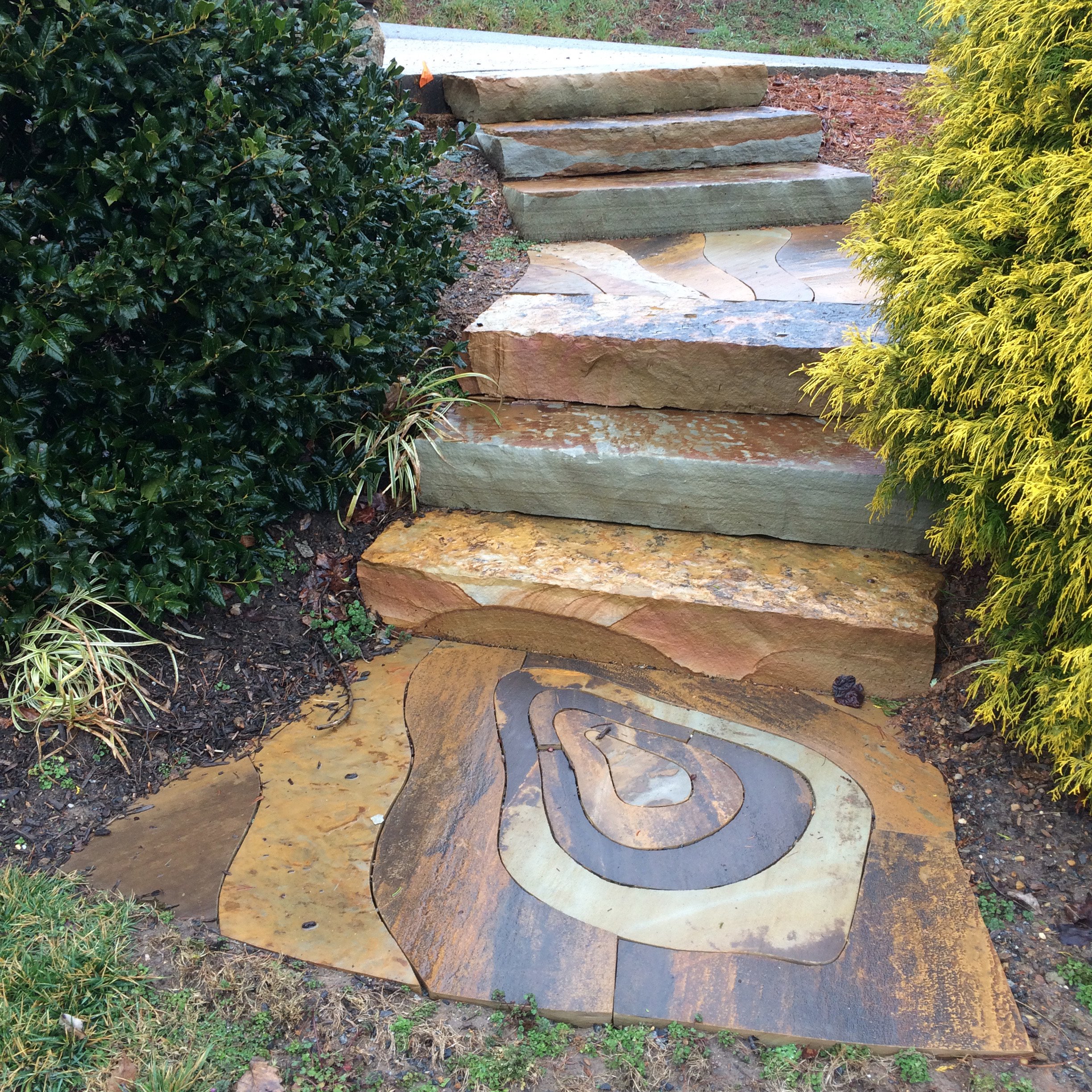
The inspiration for the pattern comes from topographic maps. If you are familiar with such maps, you know how endless lines loop and circle back to show the contours of the land. They are beautiful to look at and each bit of land has its own profile; the maps look something like fingerprints.
Topography is important to us in the mountains, and good bit of our work at Hammerhead is contending with steep ground. Sometimes we have to retain steep ground with walls, other times, like this project, we install steps to help people navigate the incline. And even when we build a mostly flat patio, we have to deal with issues of rain water and erosion. Our job is topography.
Individual stones have topography too, though we perceive that more as texture. Sometimes you will find a stone in the pile that you can imagine could be a complete cliff face, hundreds of feet tall. I called this set of steps ‘Pisgah-ish,” because the design was loosely inspired by the topographic map of the celebrated and nearby Mount Pisgah.
The stone we used was almost 3 inches thick, which made cutting it to such tight tolerances both time-consuming and delicate. After all the stones were cut, I stacked them up, taking the flat map and making it back into a typography. It would be a hard walkway to navigate if we left it that way, but it is probably my favorite image from this project.


